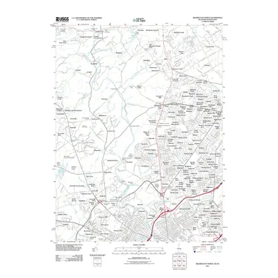
2011 Map of Wilmington North
USGS Topo · Published 2011About this map
Brandywine Creek serves as the central artery for this corridor of the Delaware-Pennsylvania border, where suburban expansion meets long-standing cultural institutions. The landscape is characterized by its large estates and gardens, notably the sprawling grounds of Winterthur Gardens and the nearby Biderman Golf Course. Higher education and regional history are represented by the Widener University Law Center and several significant burial grounds, including the Newark Union Cemetery and Saint Josephs Cemetery. In the northern section, the rail history of the region is anchored at Chadds Ford Junction, while old industrial sites like Tempest Mills and Bullocks Quarry indicate the area's transition from resource extraction and milling to a residential and educational hub. The presence of smaller aviation facilities such as Walnut Green Airport and Delaware Museum Airport highlights a unique layer of local transportation infrastructure serving private and specialized needs.
Find a feature on this map
449 named features on this map. Tap any name to fly to it.
Don’t see what you’re looking for? This feature index may not catch every label — zoom into the map to look around manually.
Map Details
Editions of this 2011 Wilmington North Map
This is the sole edition of this map. No revisions or reprints were ever made.
Other maps of this area

1890 · Salem
USGS Topo · 1:62,500

1894 · Chester
USGS Topo · 1:62,500

1896 · Chester
USGS Topo · 1:62,500

1898 · Salem
USGS Topo · 1:62,500

1898 · Chester
USGS Topo · 1:62,500

1901 · Camden
USGS Topo · 1:125,000

1901 · West Chester
USGS Topo · 1:62,500

1904 · West Chester
USGS Topo · 1:62,500

1904 · Wilmington
USGS Topo · 1:62,500

1906 · Wilmington
USGS Topo · 1:62,500