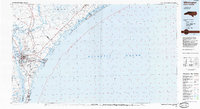
1984 Map of Wilmington
USGS Topo · Published 1985About this map
The Cape Fear River and its North East Cape Fear River fork define the maritime and industrial character of this coastal region in the mid-1980s. The city of Wilmington serves as the hub, with the campus of the Univ of N Carolina at Wilmington established to its east. Along the coast, a string of barrier island communities like Wrightsville Beach and Kure Beach are separated from the mainland by the Intracoastal Waterway and various sounds. To the south, the Military Ocean Terminal Sunny Point and Carolina Beach State Park indicate the mix of federal and recreational land use. To the north, the landscape shifts toward the dense wetlands of Holly Shelter Swamp within the Holly Shelter Game Lands, while the Seaboard railroad line tracks inland through rural junctions like Castle Hayne and Rocky Point.
Find a feature on this map
63 named features on this map. Tap any name to fly to it.
Don’t see what you’re looking for? This feature index may not catch every label — zoom into the map to look around manually.
Map Details
Editions of this 1984 Wilmington Map
This is the sole edition of this map. No revisions or reprints were ever made.
Other maps of this area

1942 · Spicer Bay
USGS Topo · 1:62,500

1942 · Topsail
USGS Topo · 1:62,500

1942 · Burgaw
USGS Topo · 1:62,500

1942 · Wilmington
USGS Topo · 1:62,500

1942 · Swansboro
USGS Topo · 1:62,500

1943 · Funston
USGS Topo · 1:24,000

1943 · Winnabow
USGS Topo · 1:24,000

1944 · Winnabow
USGS Topo · 1:31,680

1946 · Southport
USGS Topo · 1:24,000

1946 · Snow Marsh
USGS Topo · 1:24,000