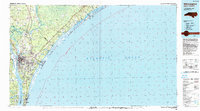
1990 Map of Wilmington
USGS Topo · Published 1990About this map
The Northeast Cape Fear River and Cape Fear River converge at Wilmington, defining a complex coastal landscape of industrial hubs and barrier island communities as they appeared in the 1990s. This USGS survey highlights the strategic importance of the Military Ocean Terminal Sunny Point alongside the extensive ecological footprint of the Holly Shelter Swamp. The map traces the winding Intracoastal Waterway as it moves past established coastal settlements like Wrightsville Beach, Masonboro, and Carolina Beach. From the inland agricultural reaches near Rocky Point and Castle Hayne to the developed shorelines at Topsail Beach, the map captures the transition between the Atlantic maritime environment and the riverine trade routes that historically built the region. Notable local landmarks like Eagle Island and Carolina Beach State Park are clearly documented among the shifting sands of the many inlets.
Find a feature on this map
51 named features on this map. Tap any name to fly to it.
Don’t see what you’re looking for? This feature index may not catch every label — zoom into the map to look around manually.
Map Details
Editions of this 1990 Wilmington Map
This is the sole edition of this map. No revisions or reprints were ever made.
Other maps of this area

1942 · Spicer Bay
USGS Topo · 1:62,500

1942 · Topsail
USGS Topo · 1:62,500

1942 · Burgaw
USGS Topo · 1:62,500

1942 · Wilmington
USGS Topo · 1:62,500

1942 · Swansboro
USGS Topo · 1:62,500

1943 · Funston
USGS Topo · 1:24,000

1943 · Winnabow
USGS Topo · 1:24,000

1944 · Winnabow
USGS Topo · 1:31,680

1946 · Southport
USGS Topo · 1:24,000

1946 · Snow Marsh
USGS Topo · 1:24,000