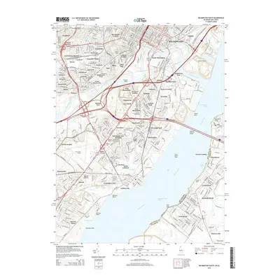
2014 Map of Wilmington South
USGS Topo · Published 2014About this map
Wilmington and its southern suburbs are defined by the convergence of the Christina River and Brandywine Creek as they flow into the Delaware River. The map illustrates a dense mosaic of residential neighborhoods and industrial corridors, featuring a high concentration of memorial sites such as Silverbrook Cem, Cathedral Cem, and Gracelawn Memorial Park. Transportation remains a central theme, from the historic rail corridor of the B And O Ln at Landenberg Junction to the modern aviation hub of the New Castle Airport. Cultural and educational institutions, including the Delaware Coll of Art and Design and Wilmington Univ, are integrated into the urban fabric. To the south, the landscape shifts toward the riverfront marshes of New Castle Flats and Dutch Neck, where the Delaware Memorial Bridges span the water toward the Delmarva Peninsula.
Find a feature on this map
111 named features on this map. Tap any name to fly to it.
Don’t see what you’re looking for? This feature index may not catch every label — zoom into the map to look around manually.
Map Details
Editions of this 2014 Wilmington South Map
This is the sole edition of this map. No revisions or reprints were ever made.
Other maps of this area

1890 · Salem
USGS Topo · 1:62,500

1894 · Chester
USGS Topo · 1:62,500

1896 · Chester
USGS Topo · 1:62,500

1898 · Salem
USGS Topo · 1:62,500

1898 · Chester
USGS Topo · 1:62,500

1901 · Camden
USGS Topo · 1:125,000

1901 · West Chester
USGS Topo · 1:62,500

1904 · West Chester
USGS Topo · 1:62,500

1904 · Wilmington
USGS Topo · 1:62,500

1906 · Wilmington
USGS Topo · 1:62,500