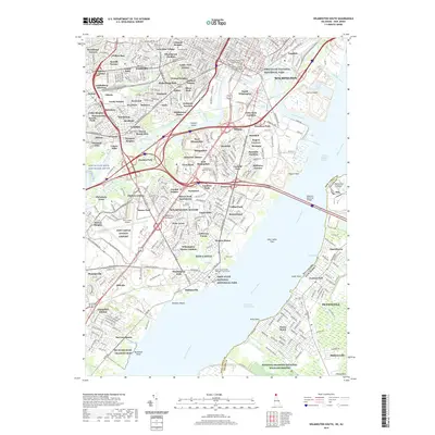
2019 Map of Wilmington South
USGS Topo · Published 2019About this map
Wilmington and the industrial riverfront of New Castle County are captured here just before the end of the decade, showing the dense network of suburban developments and the shipping lanes of the Delaware River. The urban core is flanked by numerous historic burial sites, including the extensive Gracelawn Memorial Park and the specialized Potters Field Cem, providing a detailed record for genealogical research in the area. The landscape is defined by the massive infrastructure of the Delaware Memorial Bridges and the New Castle County Airport, while pockets of preserved land like the First State National Historical Park and Supawna Meadows National Wildlife Refuge across the river in New Jersey provide a contrast to the heavy industry of Deepwater Point. This map traces the transition from the old rail crossroads at Landenberg Junction to the modern logistics hubs that dominate the tidal flats today.
Find a feature on this map
138 named features on this map. Tap any name to fly to it.
Don’t see what you’re looking for? This feature index may not catch every label — zoom into the map to look around manually.
Map Details
Editions of this 2019 Wilmington South Map
This is the sole edition of this map. No revisions or reprints were ever made.
Other maps of this area

1890 · Salem
USGS Topo · 1:62,500

1894 · Chester
USGS Topo · 1:62,500

1896 · Chester
USGS Topo · 1:62,500

1898 · Salem
USGS Topo · 1:62,500

1898 · Chester
USGS Topo · 1:62,500

1901 · Camden
USGS Topo · 1:125,000

1901 · West Chester
USGS Topo · 1:62,500

1904 · West Chester
USGS Topo · 1:62,500

1904 · Wilmington
USGS Topo · 1:62,500

1906 · Wilmington
USGS Topo · 1:62,500