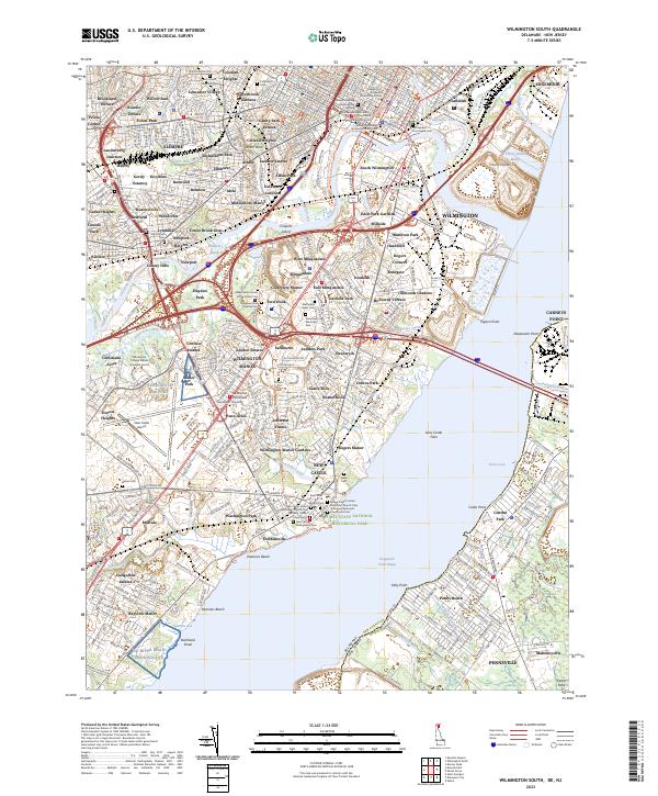
2023 Map of Wilmington South
USGS Topo · Published 2023About this map
Old Swedes Churchyard Cem and several other historic burial grounds anchor this detailed survey of the Wilmington area, reflecting centuries of settlement along the Christina River. The landscape is a complex mix of industrial corridors, suburban expansion, and preserved marshes like Fern Hook Marsh and Cherry Island Marsh. In the southern portion, the city of New Castle retains its historic layout near the Broad Dyke Canal and the First State National Historical Park.
Find a feature on this map
182 named features on this map. Tap any name to fly to it.
Don’t see what you’re looking for? This feature index may not catch every label — zoom into the map to look around manually.
Map Details
Editions of this 2023 Wilmington South Map
This is the sole edition of this map. No revisions or reprints were ever made.
Other maps of this area

1890 · Salem
USGS Topo · 1:62,500

1894 · Chester
USGS Topo · 1:62,500

1896 · Chester
USGS Topo · 1:62,500

1898 · Salem
USGS Topo · 1:62,500

1898 · Chester
USGS Topo · 1:62,500

1901 · Camden
USGS Topo · 1:125,000

1901 · West Chester
USGS Topo · 1:62,500

1904 · West Chester
USGS Topo · 1:62,500

1904 · Wilmington
USGS Topo · 1:62,500

1906 · Wilmington
USGS Topo · 1:62,500