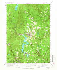
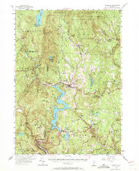
1954 Map of Wilmington
USGS Topo · Published 1966About this map
The Deerfield River and its major impoundments dominate this mid-century survey of the Green Mountains, showcasing the critical water-power infrastructure of southern Vermont. Massive bodies like the Somerset Reservoir and Harriman Reservoir are central to the landscape, supporting facilities such as the Harriman Power Plant and a Pumping Sta near the Searsburg Reservoir. These engineered lakes contrast with the older, distributed settlement patterns found in villages like Wilmington, Jacksonville, and West Dover.
Find a feature on this map
117 named features on this map. Tap any name to fly to it.
Don’t see what you’re looking for? This feature index may not catch every label — zoom into the map to look around manually.
Map Details
Editions of this 1954 Wilmington Map
5 editions found
Other maps of this area

1886 · Greylock
USGS Topo · 1:62,500

1886 · Hawley
USGS Topo · 1:62,500

1889 · Wilmington
USGS Topo · 1:62,500

1890 · Hawley
USGS Topo · 1:62,500

1890 · Greenfield
USGS Topo · 1:62,500

1891 · Wilmington
USGS Topo · 1:62,500

1891 · Greylock
USGS Topo · 1:62,500

1891 · Brattleboro
USGS Topo · 1:62,500

1893 · Brattleboro
USGS Topo · 1:62,500

1893 · Greylock
USGS Topo · 1:62,500