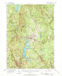
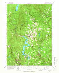
1954 Map of Wilmington
USGS Topo · Published 1971About this map
Green Mountain National Forest dominates the terrain of this southern Vermont survey, where the valley of the Deerfield River has been transformed by significant mid-century hydroelectric developments. The massive Harriman Reservoir and Somerset Reservoir anchor the landscape, their waters bounded by Harriman Dam and the settlement of Medburyville. The map captures a moment when traditional hill farming and logging were being supplemented by the growth of winter recreation, evidenced by the Hogback Ski Area and the Molly Stark Lookout State Forest Tower on Hogback Mountain. Genealogists will find a wealth of specific local data, including numerous family-named landmarks like Hosley Hill and a dense network of burial grounds such as Averell Cem, Riverview Cem, and the Dover Center Cem. Small community hubs like Jacksonville, Readsboro, and Heartwellville serve as focal points for the winding mountain roads.
Find a feature on this map
112 named features on this map. Tap any name to fly to it.
Don’t see what you’re looking for? This feature index may not catch every label — zoom into the map to look around manually.
Map Details
Editions of this 1954 Wilmington Map
5 editions found
Other maps of this area

1886 · Greylock
USGS Topo · 1:62,500

1886 · Hawley
USGS Topo · 1:62,500

1889 · Wilmington
USGS Topo · 1:62,500

1890 · Hawley
USGS Topo · 1:62,500

1890 · Greenfield
USGS Topo · 1:62,500

1891 · Wilmington
USGS Topo · 1:62,500

1891 · Greylock
USGS Topo · 1:62,500

1891 · Brattleboro
USGS Topo · 1:62,500

1893 · Brattleboro
USGS Topo · 1:62,500

1893 · Greylock
USGS Topo · 1:62,500