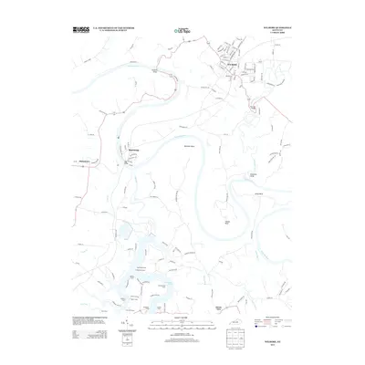
2013 Map of Wilmore
USGS Topo · Published 2013About this map
The Kentucky River carves a dramatic path through this central Kentucky landscape, defining a series of sharp meanders including Bowmans Bend, Handys Bend, and Pollys Bend. The settlement of Wilmore occupies the northern uplands, while the southern portion of the map is dominated by the finger-like inlets of Herrington Lake. This waterway transition is particularly evident where the Dix River meets the larger river system, a geography that has long influenced regional travel and settlement patterns.
Find a feature on this map
136 named features on this map. Tap any name to fly to it.
Don’t see what you’re looking for? This feature index may not catch every label — zoom into the map to look around manually.
Map Details
Editions of this 2013 Wilmore Map
This is the sole edition of this map. No revisions or reprints were ever made.
Other maps of this area

1905 · Harrodsburg
USGS Topo · 1:125,000

1950 · Bryantsville
USGS Topo · 1:24,000

1952 · Keene
USGS Topo · 1:24,000

1952 · Little Hickman
USGS Topo · 1:24,000

1952 · Nicholasville
USGS Topo · 1:24,000

1952 · Buckeye
USGS Topo · 1:24,000

1952 · Danville
USGS Topo · 1:24,000

1952 · Harrodsburg
USGS Topo · 1:24,000

1952 · Bryantsville
USGS Topo · 1:24,000

1952 · Salvisa
USGS Topo · 1:24,000