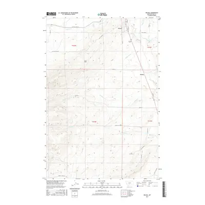
2017 Map of Wilsall
USGS Topo · Published 2017About this map
The upper Shields River valley unfolds across this topographical survey, centered on the communities of Wilsall and Shields. The landscape is defined by the prominent Battle Ridge to the west and the meandering course of the Shields River as it passes through Shields Canyon in the east. The settlement of Wilsall is the primary hub, showing a grid of streets including N Cooper St and Elliott St N, with the Wilsall Cem located just south of town along the river bluffs.
Find a feature on this map
33 named features on this map. Tap any name to fly to it.
Don’t see what you’re looking for? This feature index may not catch every label — zoom into the map to look around manually.
Map Details
Editions of this 2017 Wilsall Map
This is the sole edition of this map. No revisions or reprints were ever made.
Other maps of this area

1886 · Little Belt Mts.
USGS Topo · 1:250,000

1891 · Livingston
USGS Topo · 1:250,000

1893 · Livingston
USGS Topo · 1:250,000

1894 · Little Belt Mts.
USGS Topo · 1:250,000

1897 · Little Belt Mts.
USGS Topo · 1:250,000

1898 · Little Belt Mts.
USGS Topo · 1:250,000

1902 · Little Belt Mts.
USGS Topo · 1:250,000

1947 · Bozeman
USGS Topo · 1:250,000

1948 · Bozeman
USGS Topo · 1:250,000

1948 · White Sulphur Springs
USGS Topo · 1:250,000