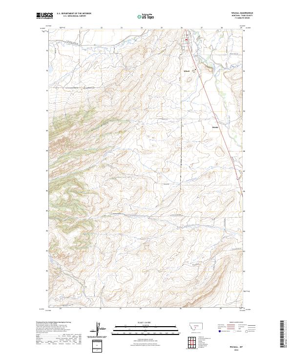
2024 Map of Wilsall
USGS Topo · Published 2024About this map
Wilsall serves as the primary settlement hub for this portion of Park County, positioned at the intersection of local routes and the northern reach of the Shields River. The town's grid, featuring streets like Elliot St N and N Darling St, gives way to a sprawling landscape defined by traditional ranching and agricultural tracts. Outside the village, the Wilsall Cem provides a genealogical anchor for the community. The terrain is marked by the prominent Battle Ridge to the west, while a complex network of waterways including Flathead Creek, Antelope Creek, and Looking Glass Creek drains the surrounding basins. This contemporary survey preserves the names of early family-named corridors such as Miller Rd and Hereim Ln, which follow the contours of the valley as it transitions into more high-altitude range land.
Find a feature on this map
35 named features on this map. Tap any name to fly to it.
Don’t see what you’re looking for? This feature index may not catch every label — zoom into the map to look around manually.
Map Details
Editions of this 2024 Wilsall Map
This is the sole edition of this map. No revisions or reprints were ever made.
Other maps of this area

1886 · Little Belt Mts.
USGS Topo · 1:250,000

1891 · Livingston
USGS Topo · 1:250,000

1893 · Livingston
USGS Topo · 1:250,000

1894 · Little Belt Mts.
USGS Topo · 1:250,000

1897 · Little Belt Mts.
USGS Topo · 1:250,000

1898 · Little Belt Mts.
USGS Topo · 1:250,000

1902 · Little Belt Mts.
USGS Topo · 1:250,000

1947 · Bozeman
USGS Topo · 1:250,000

1948 · Bozeman
USGS Topo · 1:250,000

1948 · White Sulphur Springs
USGS Topo · 1:250,000