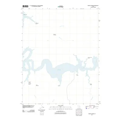
2011 Map of Wilson Creek
USGS Topo · Published 2011About this map
Lake Powell dominates this corner of San Juan County, its winding shoreline carving through a labyrinth of named canyons and geologic landmarks. In the northern reaches, Register Rock stands near the mouth of Cottonwood Canyon, while the high country to the south is marked by the Glass Mountains. The map provides a detailed view of the intricate drainage systems feeding into the reservoir, including Wilson Creek and Cottonwood Creek, which pass through high points like Aladdins Lamp Pass. Along the southern banks, the terrain is deeply incised by a series of dramatic geographic features such as Shoot the Chute Canyon, Trail Canyon, and Desha Canyon. This 2011 survey records the modern extent of the lake and the surrounding wilderness as it appeared in the early 21st century, illustrating the intersection of established water levels and the ancient topography of the Colorado Plateau.
Find a feature on this map
17 named features on this map. Tap any name to fly to it.
Don’t see what you’re looking for? This feature index may not catch every label — zoom into the map to look around manually.
Map Details
Editions of this 2011 Wilson Creek Map
This is the sole edition of this map. No revisions or reprints were ever made.
Other maps of this area

1886 · Henry Mountains
USGS Topo · 1:250,000

1892 · Henry Mountains
USGS Topo · 1:250,000

1953 · Navajo Mountain 4 NW
USGS Topo · 1:24,000

1953 · Navajo Mountain 4 SW
USGS Topo · 1:24,000

1953 · The Rincon
USGS Topo · 1:62,500

1953 · Lake Canyon
USGS Topo · 1:62,500

1953 · Navajo Mountain
USGS Topo · 1:62,500

1953 · No Mans Mesa
USGS Topo · 1:62,500

1956 · Escalante
USGS Topo · 1:250,000

1960 · Escalante
USGS Topo · 1:250,000