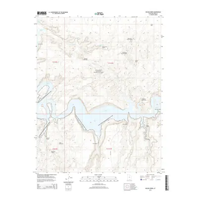
2014 Map of Wilson Creek
USGS Topo · Published 2014About this map
Lake Powell dominates the central landscape of this San Juan County quadrangle, where the impounded waters fill the deep labyrinthine drainages of Glen Canyon. The map illustrates a complex geological interface within the Glen Canyon National Recreation Area, where high plateaus like Grey Mesa and Wilson Mesa overlook a network of submerged canyons. Notable landmarks such as Old Settler Natural Bridge and Aladdins Lamp Pass highlight the dramatic relief of the terrain.
Find a feature on this map
28 named features on this map. Tap any name to fly to it.
Don’t see what you’re looking for? This feature index may not catch every label — zoom into the map to look around manually.
Map Details
Editions of this 2014 Wilson Creek Map
This is the sole edition of this map. No revisions or reprints were ever made.
Other maps of this area

1886 · Henry Mountains
USGS Topo · 1:250,000

1892 · Henry Mountains
USGS Topo · 1:250,000

1953 · Navajo Mountain 4 NW
USGS Topo · 1:24,000

1953 · Navajo Mountain 4 SW
USGS Topo · 1:24,000

1953 · The Rincon
USGS Topo · 1:62,500

1953 · Lake Canyon
USGS Topo · 1:62,500

1953 · Navajo Mountain
USGS Topo · 1:62,500

1953 · No Mans Mesa
USGS Topo · 1:62,500

1956 · Escalante
USGS Topo · 1:250,000

1960 · Escalante
USGS Topo · 1:250,000