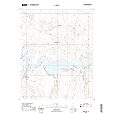
2020 Map of Wilson Creek
USGS Topo · Published 2020About this map
Lake Powell and the San Juan River dominate this desert landscape within the Glen Canyon National Recreation Area. The terrain is defined by dramatic elevation changes, featuring prominent plateaus such as Grey Mesa and Wilson Mesa, alongside the striking peaks of the Glass Mountains. Notable geological landmarks like Old Settler Natural Bridge and Aladdins Lamp Pass suggest the traditional routes and natural wonders of this remote region. The map details the complex drainage systems where Cottonwood Creek and Nasia Creek carve through the mesa country. Deep incisions in the earth are documented through named features like Shoot the Chute Canyon, Bald Rock Canyon, and Cha Canyon, illustrating the erosive power of water in this arid environment before it reaches Cha Bay.
Find a feature on this map
24 named features on this map. Tap any name to fly to it.
Don’t see what you’re looking for? This feature index may not catch every label — zoom into the map to look around manually.
Map Details
Editions of this 2020 Wilson Creek Map
This is the sole edition of this map. No revisions or reprints were ever made.
Other maps of this area

1886 · Henry Mountains
USGS Topo · 1:250,000

1892 · Henry Mountains
USGS Topo · 1:250,000

1953 · Navajo Mountain 4 NW
USGS Topo · 1:24,000

1953 · Navajo Mountain 4 SW
USGS Topo · 1:24,000

1953 · The Rincon
USGS Topo · 1:62,500

1953 · Lake Canyon
USGS Topo · 1:62,500

1953 · Navajo Mountain
USGS Topo · 1:62,500

1953 · No Mans Mesa
USGS Topo · 1:62,500

1956 · Escalante
USGS Topo · 1:250,000

1960 · Escalante
USGS Topo · 1:250,000