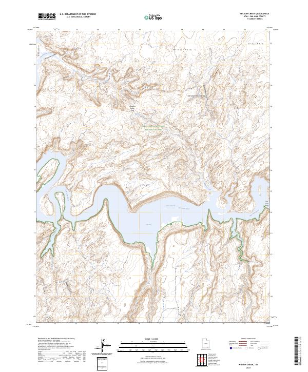
2023 Map of Wilson Creek
USGS Topo · Published 2023About this map
Glen Canyon National Recreation Area dominates this landscape, where the waters of the San Juan River and Lake Powell meet. The terrain is defined by a dense network of high mesas and deep-cut drainages, including Cottonwood Canyon and the evocatively named Shoot the Chute Canyon. A notable landmark for hikers and geologists is the Old Settler Natural Bridge, situated north of Wilson Creek.
Find a feature on this map
22 named features on this map. Tap any name to fly to it.
Don’t see what you’re looking for? This feature index may not catch every label — zoom into the map to look around manually.
Map Details
Editions of this 2023 Wilson Creek Map
This is the sole edition of this map. No revisions or reprints were ever made.
Other maps of this area

1886 · Henry Mountains
USGS Topo · 1:250,000

1892 · Henry Mountains
USGS Topo · 1:250,000

1953 · Navajo Mountain 4 NW
USGS Topo · 1:24,000

1953 · Navajo Mountain 4 SW
USGS Topo · 1:24,000

1953 · The Rincon
USGS Topo · 1:62,500

1953 · Lake Canyon
USGS Topo · 1:62,500

1953 · Navajo Mountain
USGS Topo · 1:62,500

1953 · No Mans Mesa
USGS Topo · 1:62,500

1956 · Escalante
USGS Topo · 1:250,000

1960 · Escalante
USGS Topo · 1:250,000