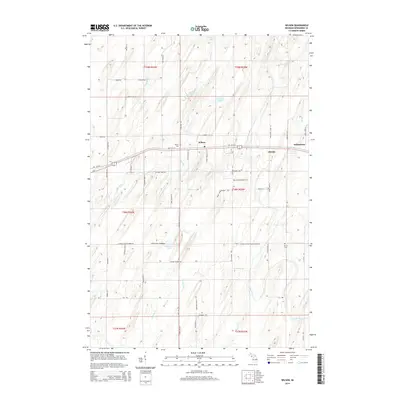
2014 Map of Wilson
USGS Topo · Published 2014About this map
Wilson serves as the central hub of this Upper Peninsula landscape, situated along the corridor of Us-2 in Nadeau Township. The map illustrates a rural settlement pattern defined by family-named roads and agrarian land divisions, where Indiantown and the smaller cluster at Houle reflect the local heritage of Menominee County. The hydraulic character of the region is shaped by the Cedar River, which meanders through the southern half of the quadrangle, joined by numerous tributaries including Wilson Creek, Gorginski Cr, and Mashek Cr. Cultural sites like Wilson Cem and Harris Cem are vital markers for genealogical research, while the presence of Cheese Factory Road Number 38 points to the area's historical dairy industry. From the northern reaches near Indian Lake to the timbered areas surrounding Arnold Lake, the map records a landscape where township lines and rural routes like Co Road 557 dictate the flow of local movement.
Find a feature on this map
66 named features on this map. Tap any name to fly to it.
Don’t see what you’re looking for? This feature index may not catch every label — zoom into the map to look around manually.
Map Details
Editions of this 2014 Wilson Map
This is the sole edition of this map. No revisions or reprints were ever made.
Other maps of this area

1932 · Bark River NE
USGS Topo · 1:31,680

1932 · Whitney SE
USGS Topo · 1:31,680

1954 · Escanaba
USGS Topo · 1:250,000

1956 · Foster City
USGS Topo · 1:62,500

1957 · Escanaba
USGS Topo · 1:250,000

1958 · Escanaba
USGS Topo · 1:250,000

1963 · Bark River
USGS Topo · 1:62,500

1963 · Powers
USGS Topo · 1:62,500

1963 · Schaffer
USGS Topo · 1:62,500

1982 · Escanaba
USGS Topo · 1:100,000