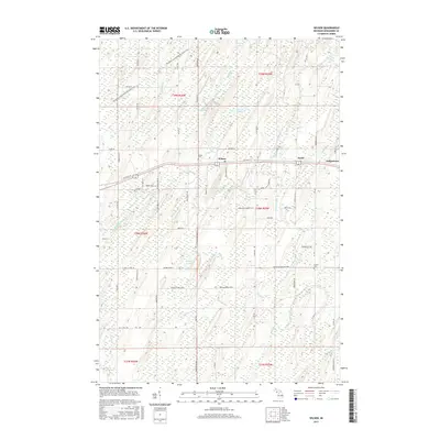
2017 Map of Wilson
USGS Topo · Published 2017About this map
Wilson and the nearby settlements of Houle and Indiantown occupy a landscape defined by the northern Michigan wilderness and the slow drainage of the Cedar River basin. This 2017 study illustrates a network of rural roads and section lines typical of Menominee County, where local history is anchored by the Wilson Cem and Harris Cem. The terrain is remarkably watery, crisscrossed by Wilson Creek, Brook Cr, and Gordon Cr, alongside smaller basins like Indian Lake and Kitchner Lake. Transport history is visible in the corridor of Old Hwy 2 41 and the Escanaba to Hermansville State Trail, which traces a former rail grade across the northern half of the map. Traces of early education and local community remain in road names like Vessel School 38 Rd and Spring Green 38 Rd, pointing to the rural infrastructure that once supported the surrounding timber and agricultural lands.
Find a feature on this map
75 named features on this map. Tap any name to fly to it.
Don’t see what you’re looking for? This feature index may not catch every label — zoom into the map to look around manually.
Map Details
Editions of this 2017 Wilson Map
This is the sole edition of this map. No revisions or reprints were ever made.
Other maps of this area

1932 · Bark River NE
USGS Topo · 1:31,680

1932 · Whitney SE
USGS Topo · 1:31,680

1954 · Escanaba
USGS Topo · 1:250,000

1956 · Foster City
USGS Topo · 1:62,500

1957 · Escanaba
USGS Topo · 1:250,000

1958 · Escanaba
USGS Topo · 1:250,000

1963 · Bark River
USGS Topo · 1:62,500

1963 · Powers
USGS Topo · 1:62,500

1963 · Schaffer
USGS Topo · 1:62,500

1982 · Escanaba
USGS Topo · 1:100,000