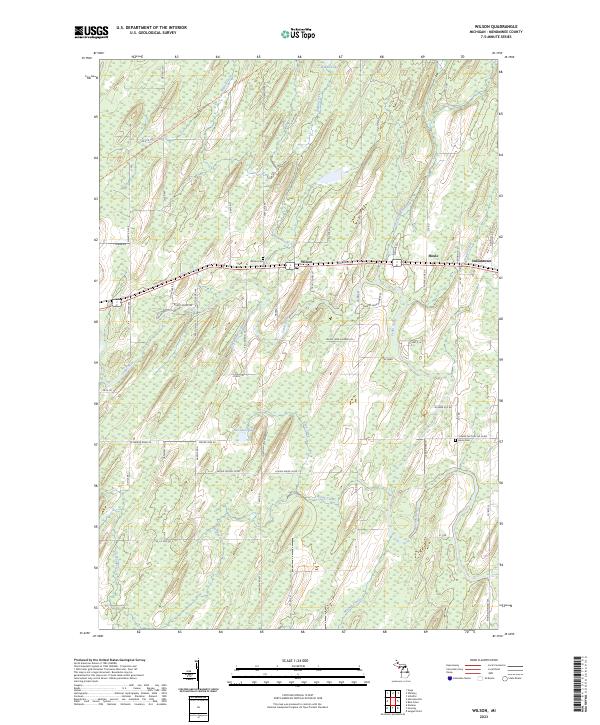
2023 Map of Wilson
USGS Topo · Published 2023About this map
Wilson and the nearby settlements of Houle and Indiantown anchor this rural landscape in Menominee County, defined by a dense network of wetlands and small waterways. The Cedar River and its numerous tributaries, including Wilson Creek, Garginski Creek, and Brook Creek, wind through the township ranges, reflecting the hydrologic complexity of the Upper Peninsula. Human settlement is oriented around Old Hwy 2 41, with local genealogy interests represented by the Wilson Cem and Harris Cem. The mapping of sections within T38N and T39N reveals a pattern of dispersed homesteads and orchards, while the Escanaba To Hermansville State Trl follows a former corridor through the northern woods. From Indian Lake in the north to Mashek Creek in the south, the map illustrates the persistent intersection of timberland, small-scale agriculture, and family-named roads like Lafave Lane D 3 and Carlson Ln H.
Find a feature on this map
73 named features on this map. Tap any name to fly to it.
Don’t see what you’re looking for? This feature index may not catch every label — zoom into the map to look around manually.
Map Details
Editions of this 2023 Wilson Map
This is the sole edition of this map. No revisions or reprints were ever made.
Other maps of this area

1932 · Bark River NE
USGS Topo · 1:31,680

1932 · Whitney SE
USGS Topo · 1:31,680

1954 · Escanaba
USGS Topo · 1:250,000

1956 · Foster City
USGS Topo · 1:62,500

1957 · Escanaba
USGS Topo · 1:250,000

1958 · Escanaba
USGS Topo · 1:250,000

1963 · Bark River
USGS Topo · 1:62,500

1963 · Powers
USGS Topo · 1:62,500

1963 · Schaffer
USGS Topo · 1:62,500

1982 · Escanaba
USGS Topo · 1:100,000