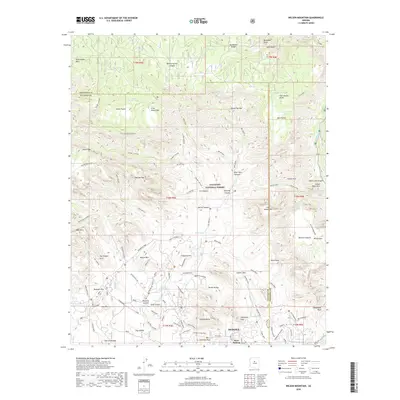
2018 Map of Wilson Mountain
USGS Topo · Published 2018About this map
Sedona and West Sedona anchor the southern edge of this survey, where the suburban grid meets the complex geology of the Coconino National Forest. The landscape is defined by massive sandstone formations and named promontories, including the iconic Steamboat Rock and Coffeepot Rock. A dense network of modern recreational trails and fire roads, such as the Chuckwagon and Jim Thompson routes, wind through the canyons and over high mesas like Brins Mesa. Natural landmarks and geological curiosities are mapped in detail, ranging from the Fay Canyon Arch and Vultee Arch to the prominent heights of Wilson Mountain and Secret Mountain. The drainage patterns of Oak Creek and Dry Creek illustrate the hydrologic forces that shaped this transition from the high plateau down toward the Verde Valley.
Find a feature on this map
98 named features on this map. Tap any name to fly to it.
Don’t see what you’re looking for? This feature index may not catch every label — zoom into the map to look around manually.
Map Details
Editions of this 2018 Wilson Mountain Map
This is the sole edition of this map. No revisions or reprints were ever made.
Other maps of this area

1886 · San Francisco Mtns
USGS Topo · 1:250,000

1887 · Verde
USGS Topo · 1:250,000

1891 · San Francisco Mtns
USGS Topo · 1:250,000

1892 · Verde
USGS Topo · 1:250,000

1894 · San Francisco Mtns
USGS Topo · 1:250,000

1899 · San Francisco Mtns
USGS Topo · 1:250,000

1908 · Flagstaff
USGS Topo · 1:125,000

1912 · Flagstaff
USGS Topo · 1:125,000

1923 · Camp Verde
USGS Topo · 1:125,000

1932 · Camp Verde
USGS Topo · 1:125,000