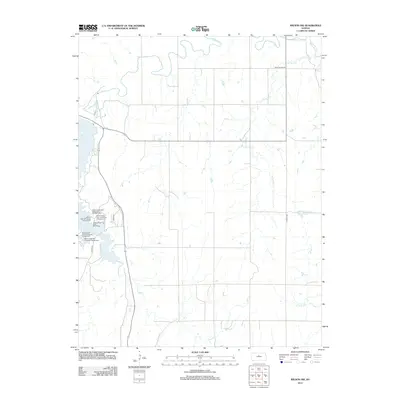
2012 Map of Wilson NW
USGS Topo · Published 2012About this map
Saline River meanders across the northern reaches of this Lincoln County landscape, while the expansive waters of Wilson Lake dominate the western edge. This 2012 survey documents a region defined by water management and outdoor recreation, particularly within the diverse sections of Wilson State Park. The shoreline is meticulously divided into specialized areas such as Wilson State Park Goldenrod Campground and Wilson State Park Yucca Campground, highlighting the modern development of this reservoir-centered environment. Away from the lake, the terrain is etched by drainage networks including W Twin Cr and Hell Cr, with a grid of rural routes like Rock Island Rd and N 60th Rd providing access to the interior. Small inland bodies of water like Highland Lake dot the eastern plains, marking a shift from the larger reservoir's influence.
Find a feature on this map
16 named features on this map. Tap any name to fly to it.
Don’t see what you’re looking for? This feature index may not catch every label — zoom into the map to look around manually.
Map Details
Editions of this 2012 Wilson NW Map
This is the sole edition of this map. No revisions or reprints were ever made.
Other maps of this area

1894 · Ellsworth
USGS Topo · 1:125,000

1894 · Beloit
USGS Topo · 1:125,000

1896 · Osborne
USGS Topo · 1:125,000

1896 · Russell
USGS Topo · 1:125,000

1955 · Great Bend
USGS Topo · 1:250,000

1955 · Beloit
USGS Topo · 1:250,000

1956 · Wilson
USGS Topo · 1:24,000

1956 · Dorrance
USGS Topo · 1:24,000

1957 · Great Bend
USGS Topo · 1:250,000

1957 · Black Wolf
USGS Topo · 1:24,000