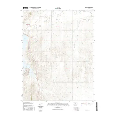
2016 Map of Wilson NW
USGS Topo · Published 2016About this map
The Saline River winds through the northern reaches of this Lincoln County landscape, defining a terrain shaped by water and early transportation routes. Just to the west, the expansive Wilson Lake meets the shore at points like Marina Loop and Outlet Blvd, indicating the importance of water management and recreation in the modern era. The survey highlights a sparse but intentional network of section-line roads and family-named routes, such as Rock Island Rd, which hints at the region's railroad history.
Find a feature on this map
30 named features on this map. Tap any name to fly to it.
Don’t see what you’re looking for? This feature index may not catch every label — zoom into the map to look around manually.
Map Details
Editions of this 2016 Wilson NW Map
This is the sole edition of this map. No revisions or reprints were ever made.
Other maps of this area

1894 · Ellsworth
USGS Topo · 1:125,000

1894 · Beloit
USGS Topo · 1:125,000

1896 · Osborne
USGS Topo · 1:125,000

1896 · Russell
USGS Topo · 1:125,000

1955 · Great Bend
USGS Topo · 1:250,000

1955 · Beloit
USGS Topo · 1:250,000

1956 · Wilson
USGS Topo · 1:24,000

1956 · Dorrance
USGS Topo · 1:24,000

1957 · Great Bend
USGS Topo · 1:250,000

1957 · Black Wolf
USGS Topo · 1:24,000