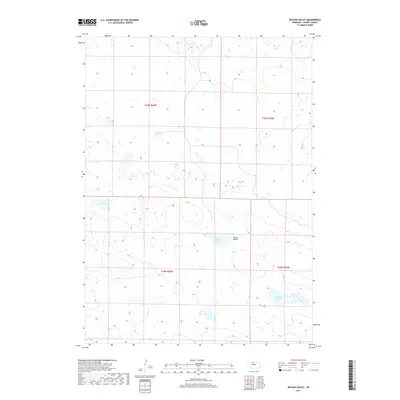
2017 Map of Wilson Valley
USGS Topo · Published 2017About this map
Wilson Valley characterizes this stretch of the Nebraska Sandhills, where the undulating landscape is defined by its characteristic depressions and wetlands. The area is marked by a scattering of small water bodies, most notably Rat Lake in the northwest and the duo of Skull Lake and Little Skull Lake to the south. This terrain represents the classic geography of Cherry County, where the high water table in the valleys creates these essential watering holes. Surveyed in the early 21st century, the map illustrates the precise township and range boundaries including t29n r26w, t29n r25w, t28n r26w, and t28n r25w, revealing a land largely dedicated to ranching and natural preservation rather than dense settlement.
Find a feature on this map
8 named features on this map. Tap any name to fly to it.
Don’t see what you’re looking for? This feature index may not catch every label — zoom into the map to look around manually.
Map Details
Editions of this 2017 Wilson Valley Map
This is the sole edition of this map. No revisions or reprints were ever made.
Other maps of this area

1949 · Long Lake
USGS Topo · 1:62,500

1950 · Wood Lake
USGS Topo · 1:62,500

1950 · Arabia
USGS Topo · 1:62,500

1951 · Long Lake
USGS Topo · 1:62,500

1951 · Moon Lake
USGS Topo · 1:62,500

1957 · Valentine
USGS Topo · 1:250,000

1959 · Valentine
USGS Topo · 1:250,000

1985 · Long Lake
USGS Topo · 1:24,000

1985 · Wilson Valley
USGS Topo · 1:24,000
1985 · Brush Creek
USGS Topo · 1:24,000