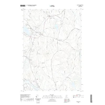
2021 Map of Wilton
USGS Topo · Published 2021About this map
The industrial and agricultural villages of Wilton and Jay anchor this study of Franklin and Androscoggin Counties. Water power from Wilson Stream and the Androscoggin River historically drove the local economy, supporting the developed centers at East Wilton, Dryden, and North Jay. The map details a dense network of local roads such as Cemetary RD and Depot ST, which connect various family-named landmarks and upland farms. Numerous burial grounds, including Lakeview Cem and the small Stubbs Mill Cem near James Brook, provide significant data points for genealogists tracing early families in the region. The landscape transitions from the river lowlands to prominent heights like Spruce Mtn and Macomber Hill, while bodies of water like Wilson Pond and Parker Pond define the western and southeastern corners of the quadrangle. This documentation provides a clear view of the settlement patterns where hills and streams dictated the placement of homesteads and crossroads like Beans Corner.
Find a feature on this map
120 named features on this map. Tap any name to fly to it.
Don’t see what you’re looking for? This feature index may not catch every label — zoom into the map to look around manually.
Map Details
Editions of this 2021 Wilton Map
This is the sole edition of this map. No revisions or reprints were ever made.
Other maps of this area

1910 · Livermore
USGS Topo · 1:62,500

1911 · Buckfield
USGS Topo · 1:62,500

1912 · Livermore
USGS Topo · 1:62,500

1913 · Buckfield
USGS Topo · 1:62,500

1924 · Farmington
USGS Topo · 1:62,500

1926 · Dixfield
USGS Topo · 1:62,500

1929 · Dixfield
USGS Topo · 1:62,500

1941 · Livermore
USGS Topo · 1:62,500

1942 · Buckfield
USGS Topo · 1:62,500

1950 · Lewiston
USGS Topo · 1:250,000