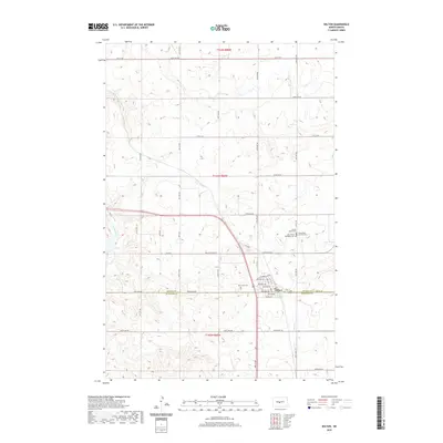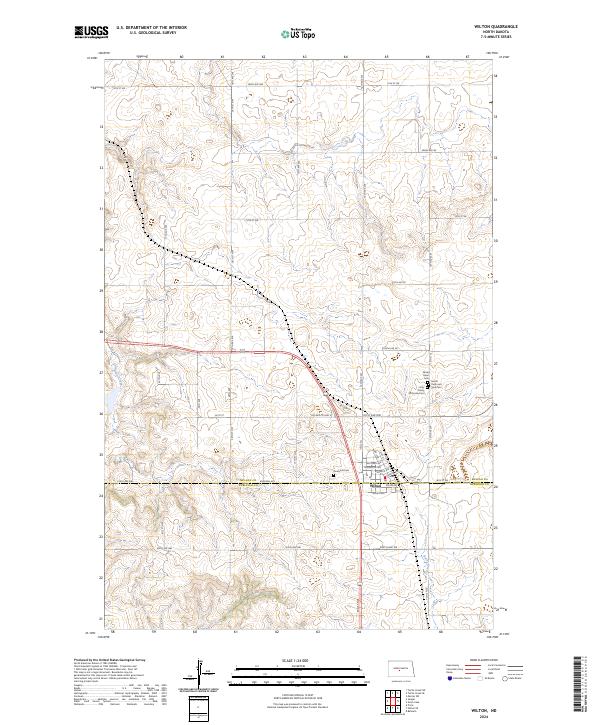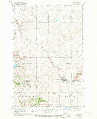
1966 Map of Wilton
USGS Topo · Published 1967About this map
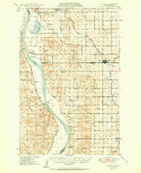
Wilton stands as the central hub of this mid-1960s prairie survey, situated precisely where the McLean Co Burleigh Co line divides the landscape. The town's religious and community history is anchored by a cluster of sites including the Sacred Heart Cem SS Peter and Paul Cem St Nicholas Cem and the Riverview Cem to the south. The area's industrial legacy is evident in the transition of land use, most notably at the Wilton Mine State Game Management Area, indicating a shift from resource extraction to conservation. Transport networks dominate the geography, featuring the Soo Line and Northern Pacific railroads alongside an Old Railroad Grade. Natural drainage patterns are defined by Yanktonai Creek flowing into Yanktonai Lake, while the varied terrain of Painted Woods and Eck Lund breaks the agricultural grid of the North Dakota plains.
Find a feature on this map
15 named features on this map. Tap any name to fly to it.
Don’t see what you’re looking for? This feature index may not catch every label — zoom into the map to look around manually.
Map Details
Editions of this 1966 Wilton Map
This is the sole edition of this map. No revisions or reprints were ever made.
Historical Maps of Wilton Through Time
7 maps found