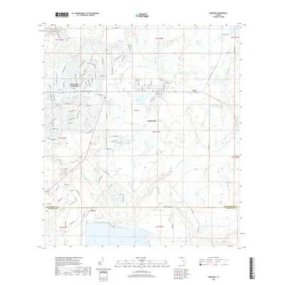
2018 Map of Wimauma
USGS Topo · Published 2018About this map
Wimauma and the neighboring planned community of Sun City Center anchor this 2018 survey of southern Hillsborough County. The landscape shows a distinct division between the dense, curvilinear residential street patterns of the retirement-focused developments to the west and the more open, traditional settlement layout of Wimauma. In the south, the village of Willow sits near the Manatee County line, where the topography shifts toward the wetlands and drainage basins of the Little Manatee River and its S Fork.
Find a feature on this map
117 named features on this map. Tap any name to fly to it.
Don’t see what you’re looking for? This feature index may not catch every label — zoom into the map to look around manually.
Map Details
Editions of this 2018 Wimauma Map
This is the sole edition of this map. No revisions or reprints were ever made.
Other maps of this area

1921 · Tampa
USGS Topo · 1:62,500

1944 · Ruskin
USGS Topo · 1:31,680

1944 · Rye
USGS Topo · 1:31,680

1944 · Wimauma
USGS Topo · 1:31,680

1944 · Parish
USGS Topo · 1:31,680

1944 · Balm
USGS Topo · 1:31,680

1945 · Gadsden Point
USGS Topo · 1:31,680

1947 · Ruskin
USGS Topo · 1:25,000

1947 · Wimauma
USGS Topo · 1:25,000
1947 · Gadsden Point
USGS Topo · 1:25,000