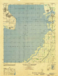
1947 Map of Gadsden Point
USGS Topo · Published 1947About this map
Mac Dill Field dominates the western peninsula of this mid-century survey, a sprawling military installation complete with its own U S Quarantine Station at Gadsden Point. Across the waters of Hillsborough Bay, the eastern shoreline reveals a series of coastal settlements and intricate waterways. Small communities like Gibsonton and Gardenville sit near the mouth of the Alafia River, while further south, the Big Bend area shows a landscape defined by creeks and inlets such as Bullfrog Creek and The Kitchen.
Find a feature on this map
30 named features on this map. Tap any name to fly to it.
Don’t see what you’re looking for? This feature index may not catch every label — zoom into the map to look around manually.
Map Details
Editions of this 1947 Gadsden Point Map
This is the sole edition of this map. No revisions or reprints were ever made.
Other maps of this area

1921 · Tampa
USGS Topo · 1:62,500

1921 · Fort De Soto
USGS Topo · 1:62,500

1921 · St Petersburg
USGS Topo · 1:62,500

1942 · Cockroach Bay
USGS Topo · 1:31,680

1943 · Gandy Bridge
USGS Topo · 1:31,680

1943 · Port Tampa
USGS Topo · 1:31,680

1944 · Mango
USGS Topo · 1:31,680

1944 · Ruskin
USGS Topo · 1:31,680

1944 · Tampa
USGS Topo · 1:31,680

1944 · Wimauma
USGS Topo · 1:31,680