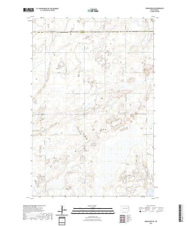
2024 Map of Wimbledon NE
USGS Topo · Published 2024About this map
The border of Griggs Co and Barnes Co runs across the northern portion of this prairie landscape, where the terrain is defined by a dense concentration of wetlands and seasonal basins. This section of North Dakota remains primarily structured by the Public Land Survey System, with a rigid grid of local roads including 101st Ave SE, 102nd Ave SE, and 103rd Ave SE carving the land into mile-square sections. The most significant conservation feature is the Barnes County Waterfowl Production Area, which spans multiple parcels in the northeastern and eastern quadrants. The high density of water features throughout this sheet illustrates the typical pothole geology of the region, providing a detailed record of the natural drainage and land management patterns used for agriculture and wildlife preservation in the modern era.
Find a feature on this map
23 named features on this map. Tap any name to fly to it.
Don’t see what you’re looking for? This feature index may not catch every label — zoom into the map to look around manually.
Map Details
Editions of this 2024 Wimbledon NE Map
This is the sole edition of this map. No revisions or reprints were ever made.
Other maps of this area

1952 · New Rockford
USGS Topo · 1:250,000

1956 · New Rockford
USGS Topo · 1:250,000

1961 · Leal
USGS Topo · 1:24,000

1961 · Revere
USGS Topo · 1:24,000

1961 · Wimbledon
USGS Topo · 1:24,000

1961 · Hannaford
USGS Topo · 1:24,000

1961 · Wimbledon NE
USGS Topo · 1:24,000

1961 · Rogers
USGS Topo · 1:24,000
1961 · Sutton SW
USGS Topo · 1:24,000

1961 · Dazey
USGS Topo · 1:24,000