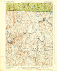
1935 Map of Winchendon
USGS Topo · Published 1935About this map
The Miller River and its industrial tributaries anchor this 1930s survey of the Massachusetts-New Hampshire borderlands, where the Fitchburg Railroad follows the winding valley floor to connect manufacturing centers. The terrain is marked by dozens of named summits, including Benjamin Hill and Tully Mtn., which overlook a dense network of water-powered mill settlements. In Winchendon, the rail lines converge near Whitney Pond and Hydeville, while the Boston and Maine Railroad cuts through the northern reaches near Sip Pond.
Find a feature on this map
104 named features on this map. Tap any name to fly to it.
Don’t see what you’re looking for? This feature index may not catch every label — zoom into the map to look around manually.
Map Details
Editions of this 1935 Winchendon Map
4 editions found
Other maps of this area

1885 · Worcester
USGS Topo · 1:62,500

1886 · Worcester
USGS Topo · 1:62,500

1887 · Warwick
USGS Topo · 1:62,500

1887 · Belchertown
USGS Topo · 1:62,500

1887 · Winchendon
USGS Topo · 1:62,500

1887 · Barre
USGS Topo · 1:62,500

1887 · Fitchburg
USGS Topo · 1:62,500

1889 · Fitchburg
USGS Topo · 1:62,500

1889 · Barre
USGS Topo · 1:62,500

1889 · Warwick
USGS Topo · 1:62,500