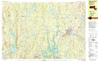
1988 Map of Winchendon
USGS Topo · Published 1988About this map
Winchendon serves as the industrial and social hub of this borderland region in the late 1980s, where the Boston & Maine railroad line intersects with the upper reaches of the Millers River. The landscape is defined by its extensive state-managed lands, including the Birch Hill State Wildlife Management Area and Otter River State Forest, which protect the wetlands and floodplains of the Otter River. Evidence of earlier settlement patterns is found at Winchendon Center and the old industrial hamlet of Winchendon Springs near the northern shore of Whitney Pond. In the western portion of the map, the terrain rises toward Tully Mtn and Chestnut Hill, where smaller settlements like Royalston and Tully are situated near the expansive Tully Lake. Local genealogy and civic history are anchored by landmarks such as Center Cem, Old Center Cem, and the Murdock High Sch.
Find a feature on this map
93 named features on this map. Tap any name to fly to it.
Don’t see what you’re looking for? This feature index may not catch every label — zoom into the map to look around manually.
Map Details
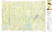
Editions of this 1988 Winchendon Map
2 editions found
Other maps of this area

1887 · Warwick
USGS Topo · 1:62,500

1887 · Winchendon
USGS Topo · 1:62,500

1887 · Fitchburg
USGS Topo · 1:62,500

1889 · Fitchburg
USGS Topo · 1:62,500

1889 · Warwick
USGS Topo · 1:62,500

1890 · Winchendon
USGS Topo · 1:62,500

1893 · Fitchburg
USGS Topo · 1:62,500

1894 · Winchendon
USGS Topo · 1:62,500

1894 · Warwick
USGS Topo · 1:62,500

1898 · Monadnock
USGS Topo · 1:62,500