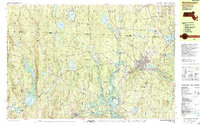
1988 Map of Winchendon
USGS Topo · Published 1988About this map
The Millers River and Otter River define the industrial and natural landscape of northern Worcester County in the late 1980s. The regional hub of Winchendon is shown in detail, where the Boston and Maine railroad line intersects the town center near Whitney Pond. Educational and religious landmarks like the Murdock High School and Immaculate Heart of Mary Church anchor the community, while the surrounding area is characterized by smaller villages such as Waterville, Hydeville, and Winchendon Springs.
Find a feature on this map
79 named features on this map. Tap any name to fly to it.
Don’t see what you’re looking for? This feature index may not catch every label — zoom into the map to look around manually.
Map Details
Editions of this 1988 Winchendon Map
2 editions found
Other maps of this area

1887 · Warwick
USGS Topo · 1:62,500

1887 · Winchendon
USGS Topo · 1:62,500

1887 · Fitchburg
USGS Topo · 1:62,500

1889 · Fitchburg
USGS Topo · 1:62,500

1889 · Warwick
USGS Topo · 1:62,500

1890 · Winchendon
USGS Topo · 1:62,500

1893 · Fitchburg
USGS Topo · 1:62,500

1894 · Winchendon
USGS Topo · 1:62,500

1894 · Warwick
USGS Topo · 1:62,500

1898 · Monadnock
USGS Topo · 1:62,500