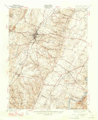
1942 Map of Winchester
USGS Topo · Published 1965About this map
Winchester serves as the focal point of this pre-war landscape, where the confluence of the Baltimore and Ohio RR and the Norfolk and Western Ry meets a network of historic thoroughfares like the Valley Pike and Northwestern Grade. The map preserves the physical remnants of the region's military history, marking the earthen defenses of Star Fort and Fort Milroy north of the city center.
Find a feature on this map
104 named features on this map. Tap any name to fly to it.
Don’t see what you’re looking for? This feature index may not catch every label — zoom into the map to look around manually.
Map Details
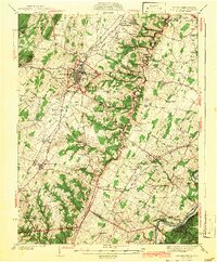
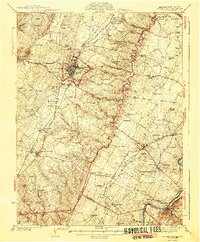
Editions of this 1942 Winchester Map
3 editions found
Other maps of this area

1884 · Harpers Ferry
USGS Topo · 1:125,000

1891 · Harpers Ferry
USGS Topo · 1:125,000

1893 · Luray
USGS Topo · 1:125,000

1893 · Harpers Ferry
USGS Topo · 1:125,000

1894 · Warrenton
USGS Topo · 1:125,000

1894 · Winchester
USGS Topo · 1:125,000

1905 · Luray
USGS Topo · 1:125,000

1914 · Martinsburg
USGS Topo · 1:48,000

1914 · Gerrardstown
USGS Topo · 1:48,000

1916 · Gerrardstown
USGS Topo · 1:62,500