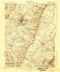
1942 Map of Winchester
USGS Topo · Published 1942About this map
The Valley Pike and Lee Jackson Highway serve as the primary conduits through this Shenandoah Valley landscape, where the city of Winchester stands as a dense hub of commerce and history. Remnants of Civil War defenses are clearly marked on the northern outskirts at Star Fort and Fort Milroy, while the agricultural character of the era is evident in the Blandy Experimental Farm and nearby Carter Hall.
Find a feature on this map
119 named features on this map. Tap any name to fly to it.
Don’t see what you’re looking for? This feature index may not catch every label — zoom into the map to look around manually.
Map Details
Editions of this 1942 Winchester Map
3 editions found

Other maps of this area

1884 · Harpers Ferry
USGS Topo · 1:125,000

1891 · Harpers Ferry
USGS Topo · 1:125,000

1893 · Luray
USGS Topo · 1:125,000

1893 · Harpers Ferry
USGS Topo · 1:125,000

1894 · Warrenton
USGS Topo · 1:125,000

1894 · Winchester
USGS Topo · 1:125,000

1905 · Luray
USGS Topo · 1:125,000

1914 · Martinsburg
USGS Topo · 1:48,000

1914 · Gerrardstown
USGS Topo · 1:48,000

1916 · Gerrardstown
USGS Topo · 1:62,500