
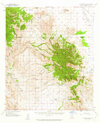
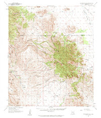
1957 Map of Winchester Mts.
USGS Topo · Published 1959About this map
The boundary between Graham and Cochise counties cuts through the center of this high-desert landscape, anchored by the rugged elevations of the Coronado National Forest. This 1957 culture revision reveals a network of remote family cattle operations and specialized locations such as Hookers Hot Springs and Muleshoe Ranch that define the regional economy. The terrain transition from the heights of Muskhog Mtn down to the sweeping Allen Flat and Sulphur Spring Valley creates a complex system of drainages, including Rattlesnake Canyon and Davis Canyon.
Find a feature on this map
54 named features on this map. Tap any name to fly to it.
Don’t see what you’re looking for? This feature index may not catch every label — zoom into the map to look around manually.
Map Details
Editions of this 1957 Winchester Mts. Map
3 editions found
Other maps of this area

1922 · Willcox
USGS Topo · 1:125,000

1938 · Galiuro Mts
USGS Topo · 1:48,000

1940 · Sierra Bonita Ranch
USGS Topo · 1:62,500

1942 · Sierra Bonita Ranch
USGS Topo · 1:62,500

1942 · Mt. Graham
USGS Topo · 1:62,500

1943 · Willcox
USGS Topo · 1:62,500

1943 · Galiuro Mts
USGS Topo · 1:62,500

1943 · Cochise
USGS Topo · 1:62,500

1943 · Dragoon
USGS Topo · 1:62,500

1943 · Sierra Bonita Ranch
USGS Topo · 1:62,500