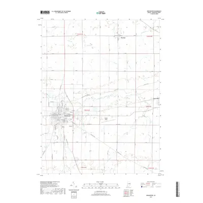
2019 Map of Winchester
USGS Topo · Published 2019About this map
Winchester serves as the central hub of this eastern Indiana landscape, where a dense grid of residential streets like W North St and E Main St meets the industrial and agricultural corridors of Randolph County. The White River winds through the heart of the region, flanked by smaller tributaries such as Salt Cr and Clear Cr. This modern survey reveals a landscape defined by its historical settlements and long-established transit routes, including the E Union City Pike connecting rural homesteads to the village of Harrisville.
Find a feature on this map
62 named features on this map. Tap any name to fly to it.
Don’t see what you’re looking for? This feature index may not catch every label — zoom into the map to look around manually.
Map Details
Editions of this 2019 Winchester Map
This is the sole edition of this map. No revisions or reprints were ever made.
Other maps of this area

1915 · Fort Recovery
USGS Topo · 1:48,000

1916 · Winchester
USGS Topo · 1:48,000

1918 · Winchester
USGS Topo · 1:62,500

1918 · Fort Recovery
USGS Topo · 1:62,500

1943 · Winchester
USGS Topo · 1:62,500

1952 · Maxville
USGS Topo · 1:24,000

1953 · Muncie
USGS Topo · 1:250,000

1956 · Muncie
USGS Topo · 1:250,000

1960 · Union City
USGS Topo · 1:24,000

1960 · Carlos
USGS Topo · 1:24,000