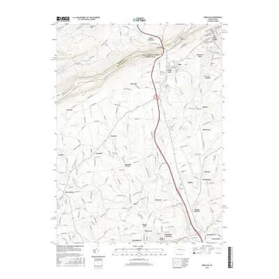
2016 Map of Wind Gap
USGS Topo · Published 2016About this map
Blue Mountain and the Appalachian National Scenic Trail dominate the northern landscape of this Northampton County region, where the prominent Wind Gap provides a natural passage through the ridge. This area serves as a transition from the elevated terrain of Chestnut Ridge to the developed valleys below. The map documents a dense network of smaller communities such as Pen Argyl, Belfast, and Schoeneck, many of which developed around the local water systems of Bushkill Creek and Sobers Run. The geography here reflects a long history of settlement patterns dictated by the gap and the surrounding creeks, with cemeteries like Evergreen Cemetery and Union Cemetery marking the established local heritage. Transport routes such as Old Grade Road and various rail-aligned corridors reveal how the industry and population shifted between the mountain heights and the southern plains of Nazareth.
Find a feature on this map
212 named features on this map. Tap any name to fly to it.
Don’t see what you’re looking for? This feature index may not catch every label — zoom into the map to look around manually.
Map Details
Editions of this 2016 Wind Gap Map
This is the sole edition of this map. No revisions or reprints were ever made.
Other maps of this area

1890 · Easton
USGS Topo · 1:62,500

1891 · Easton
USGS Topo · 1:62,500

1891 · Delaware Water Gap
USGS Topo · 1:62,500

1893 · Delaware Water Gap
USGS Topo · 1:62,500

1894 · Allentown
USGS Topo · 1:62,500

1914 · Wind Gap
USGS Topo · 1:62,500

1916 · Wind Gap
USGS Topo · 1:62,500

1932 · Easton
USGS Topo · 1:62,500

1936 · Delaware Water Gap
USGS Topo · 1:48,000

1939 · Allentown
USGS Topo · 1:62,500
Featured Places
- Pen Argyl, PA
- Wind Gap, PA
- Bushkill Township, PA
- Clearfield, Bushkill Township
- Grand Central, Plainfield Township