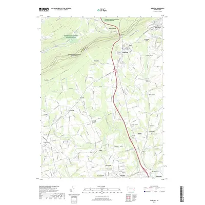
2019 Map of Wind Gap
USGS Topo · Published 2019About this map
Kittatinny Mountain dominates the northern horizon of this Northampton County landscape, famously punctuated by the Wind Gap water gap. The terrain transitions from the high ridges of the Cherry Valley National Wildlife Refuge down into a valley dense with long-established settlements. Along the southern slopes, the Appalachian National Scenic Trail traverses the ridge above the slate-belt community of Pen Argyl. The map documents a complex network of small hamlets such as Belfast, Edelman, and Bushkill Center, which are interconnected by a web of local roads following the drainage of Bushkill Creek and Little Bushkill Creek. This area's history is preserved in landmarks like Evergreen Cemetery and Union Cemetery, while the southern reaches show the development near Stockertown and East Lawn, illustrating the enduring footprint of Pennsylvania's eastern valley settlements.
Find a feature on this map
46 named features on this map. Tap any name to fly to it.
Don’t see what you’re looking for? This feature index may not catch every label — zoom into the map to look around manually.
Map Details
Editions of this 2019 Wind Gap Map
This is the sole edition of this map. No revisions or reprints were ever made.
Other maps of this area

1890 · Easton
USGS Topo · 1:62,500

1891 · Easton
USGS Topo · 1:62,500

1891 · Delaware Water Gap
USGS Topo · 1:62,500

1893 · Delaware Water Gap
USGS Topo · 1:62,500

1894 · Allentown
USGS Topo · 1:62,500

1914 · Wind Gap
USGS Topo · 1:62,500

1916 · Wind Gap
USGS Topo · 1:62,500

1932 · Easton
USGS Topo · 1:62,500

1936 · Delaware Water Gap
USGS Topo · 1:48,000

1939 · Allentown
USGS Topo · 1:62,500
Featured Places
- Pen Argyl, PA
- Wind Gap, PA
- Bushkill Township, PA
- Clearfield, Bushkill Township
- Grand Central, Plainfield Township