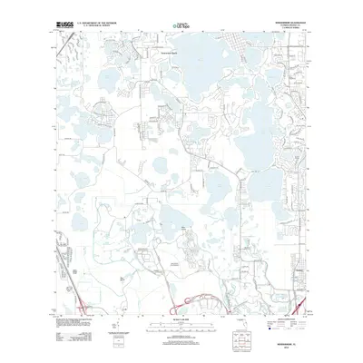
2012 Map of Windermere
USGS Topo · Published 2012About this map
Lake Butler and a dense network of surrounding water bodies dominate this central Florida landscape, illustrating the complex geography of the region as it transitioned into the early 21st century. The map highlights the established community of Doctor Phillips and the newer residential patterns developing around Summerport Beach. Significant landmarks include the Doctor Phillips Cem and the Lake Buena Vista Stolport, reflecting the intersection of local history and the modern aviation and tourism infrastructure. The intricate shoreline of Bay Lake and Lake Tibet is clearly defined, showing how the natural environment has been integrated into the suburban fabric. Waterways like Reedy Creek and Whittenhorse Cr snake through the terrain, connecting large lakes such as Lake Hancock and Lake Speer. This survey provides a precise record of the road networks and land use before subsequent decades of rapid growth altered the local character.
Find a feature on this map
142 named features on this map. Tap any name to fly to it.
Don’t see what you’re looking for? This feature index may not catch every label — zoom into the map to look around manually.
Map Details
Editions of this 2012 Windermere Map
This is the sole edition of this map. No revisions or reprints were ever made.
Other maps of this area

1953 · Lake Jessamine
USGS Topo · 1:24,000

1953 · Kissimmee
USGS Topo · 1:24,000

1953 · Windermere
USGS Topo · 1:24,000

1953 · Intercession City
USGS Topo · 1:24,000

1955 · Orlando
USGS Topo · 1:250,000

1956 · Winter Garden
USGS Topo · 1:24,000

1956 · Orlando West
USGS Topo · 1:24,000

1957 · Orlando
USGS Topo · 1:250,000

1958 · Orlando
USGS Topo · 1:250,000

1959 · Lake Louisa
USGS Topo · 1:24,000