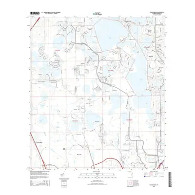
2015 Map of Windermere
USGS Topo · Published 2015About this map
Windermere and its surrounding chain of lakes dominate this 2015 landscape, illustrating the modern residential and recreational layout of Orange County. The map provides a detailed view of the intricate shoreline geography, featuring larger bodies like Lake Butler and Lake Tibet alongside smaller waters such as Lake Blanche and Pocket Lake. This era shows the extensive road networks of Summerport Beach and Bay Hill, while the southern portion of the sheet transitions into the resort-oriented infrastructure near Lake Buena Vista and Bay Lake. Local history and genealogy interests are anchored by the Doctor Phillips Cem in the northeast and established communities like Vineland. Large natural features such as Riles Island and Bear Island remain prominent within the lake systems, contrasting with the dense street grids and golf course developments like those along Isleworth Country Club Dr.
Find a feature on this map
105 named features on this map. Tap any name to fly to it.
Don’t see what you’re looking for? This feature index may not catch every label — zoom into the map to look around manually.
Map Details
Editions of this 2015 Windermere Map
This is the sole edition of this map. No revisions or reprints were ever made.
Other maps of this area

1953 · Lake Jessamine
USGS Topo · 1:24,000

1953 · Kissimmee
USGS Topo · 1:24,000

1953 · Windermere
USGS Topo · 1:24,000

1953 · Intercession City
USGS Topo · 1:24,000

1955 · Orlando
USGS Topo · 1:250,000

1956 · Winter Garden
USGS Topo · 1:24,000

1956 · Orlando West
USGS Topo · 1:24,000

1957 · Orlando
USGS Topo · 1:250,000

1958 · Orlando
USGS Topo · 1:250,000

1959 · Lake Louisa
USGS Topo · 1:24,000