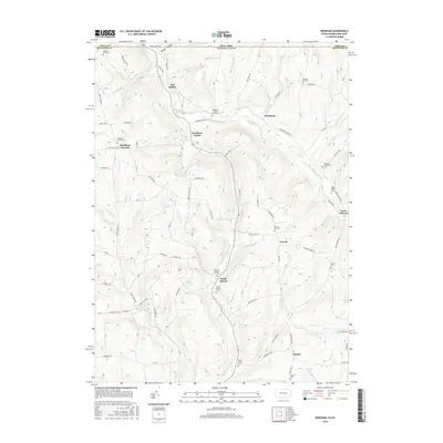
2016 Map of Windham
USGS Topo · Published 2016About this map
The borderlands between Tioga County, New York, and Bradford County, Pennsylvania, are defined by a series of narrow stream valleys and ridgelines. Wappasening Creek and Wysox Cr carve through the landscape, anchoring small settlements like Windham Center and North Orwell. The area is notably dense with small, family-associated burial grounds, including the Roswell Russell Farm Cem, Rogers Family Cem, and Babcock Hill Cem, reflecting a long history of local lineage and ancestral land ownership. Larger water bodies such as Lake Nadine and Lake Bonin sit amidst the high ground, while numerous hollows like Briggs Hollow and Cotton Hollow define the local topography. This 2016 survey highlights a persistent rural character where 19th-century settlement patterns remain visible through the distribution of small hamlets and the network of historic roads like State Line Rd and Orwell Hill Rd.
Find a feature on this map
77 named features on this map. Tap any name to fly to it.
Don’t see what you’re looking for? This feature index may not catch every label — zoom into the map to look around manually.
Map Details
Editions of this 2016 Windham Map
This is the sole edition of this map. No revisions or reprints were ever made.
Other maps of this area

1901 · Apalachin
USGS Topo · 1:62,500

1903 · Owego
USGS Topo · 1:62,500

1904 · Apalachin
USGS Topo · 1:62,500

1906 · Catatonk
USGS Topo · 1:125,000

1923 · Towanda
USGS Topo · 1:62,500

1926 · Towanda
USGS Topo · 1:62,500

1943 · Towanda
USGS Topo · 1:62,500

1943 · Le Raysville
USGS Topo · 1:62,500

1945 · Le Raysville
USGS Topo · 1:62,500

1950 · Elmira
USGS Topo · 1:250,000
Featured Places
- Owego, NY
- Orwell Township, PA
- Windham Township, PA
- Windham Center, Windham Township
- North Orwell, Orwell Township