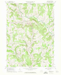
1967 Map of Windham
USGS Topo · Published 1971About this map
Wappasening Creek carves a deep valley through the northern landscape of Bradford County, defining the settlement patterns of Windham township in the late 1960s. The creek is fed by several tributaries including Cold Brook and Prince Hollow, while the southern portion of the area is drained by the headwaters of Wysox Creek. This topography creates a series of isolated upland communities and crossroads such as Windham Center, Windham Summit, and North Orwell.
Find a feature on this map
38 named features on this map. Tap any name to fly to it.
Don’t see what you’re looking for? This feature index may not catch every label — zoom into the map to look around manually.
Map Details
Editions of this 1967 Windham Map
2 editions found
Other maps of this area

1901 · Apalachin
USGS Topo · 1:62,500

1903 · Owego
USGS Topo · 1:62,500

1904 · Apalachin
USGS Topo · 1:62,500

1906 · Catatonk
USGS Topo · 1:125,000

1923 · Towanda
USGS Topo · 1:62,500

1926 · Towanda
USGS Topo · 1:62,500

1943 · Towanda
USGS Topo · 1:62,500

1943 · Le Raysville
USGS Topo · 1:62,500

1945 · Le Raysville
USGS Topo · 1:62,500

1950 · Elmira
USGS Topo · 1:250,000
Featured Places
- Owego, NY
- Orwell Township, PA
- Windham Township, PA
- West Warren, Warren Township
- Russellville, Orwell Township