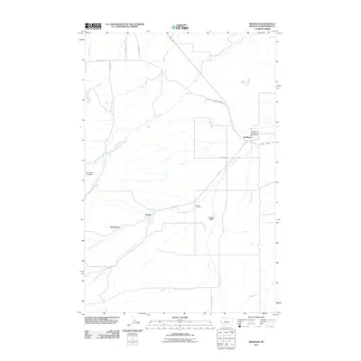
2011 Map of Windham
USGS Topo · Published 2011About this map
Leigh and Scholztown appear as modest settlements in this central Montana survey, situated south of the larger crossroads community of Windham. The geography is defined by a dendritic network of seasonal and permanent watercourses, including Willow Creek and Coyote Creek, which drain the higher ground of Pleasant Valley and Dunsmore Coulee. This 2011 record documents a largely agricultural and ranching landscape, where the Lehigh Cemetery stands as a focal point for genealogical research. Local infrastructure is anchored by the Judith Basin Rural Fire Dist Windham and a grid of rural routes like the Utica Hwy and Lehigh Rd, which connect these small prairie outposts. The map provides a clear view of the North Fork Sage Creek drainage system and the various springs and branches that have historically dictated the placement of homesteads and road networks in this part of Judith Basin County.
Find a feature on this map
18 named features on this map. Tap any name to fly to it.
Don’t see what you’re looking for? This feature index may not catch every label — zoom into the map to look around manually.
Map Details
Editions of this 2011 Windham Map
This is the sole edition of this map. No revisions or reprints were ever made.
Other maps of this area

1886 · Little Belt Mts.
USGS Topo · 1:250,000

1890 · Fort Benton
USGS Topo · 1:250,000

1892 · Fort Benton
USGS Topo · 1:250,000

1894 · Little Belt Mts.
USGS Topo · 1:250,000

1897 · Fort Benton
USGS Topo · 1:250,000

1897 · Little Belt Mts.
USGS Topo · 1:250,000

1898 · Little Belt Mts.
USGS Topo · 1:250,000

1902 · Little Belt Mts.
USGS Topo · 1:250,000

1948 · White Sulphur Springs
USGS Topo · 1:250,000

1954 · Great Falls
USGS Topo · 1:250,000