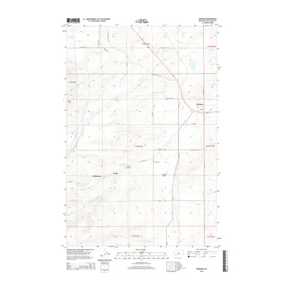
2014 Map of Windham
USGS Topo · Published 2014About this map
Lehigh and the neighboring settlement of Scholztown anchor the southern portion of this Judith Basin County landscape, situated along the winding drainage of N Fork Sage Cr. The area is defined by its high-altitude basins and prominent geological markers like Skull Butte and the broad Cayuse Basin to the northwest. This 2014 survey documents a network of rural roads such as the Utica Hwy and Lehigh Rd that connect these dispersed communities to Windham in the northeast corner. Local history is preserved at sites like the Lehigh Cem and Pleasant Valley Cem, which serve as quiet markers of the families who settled this high-plains terrain. The map details a complex hydrological system where Willow Cr and Coyote Cr carve through the foothills, illustrating the vital relationship between water sources like Coyote Spring and the development of the surrounding ranchlands.
Find a feature on this map
38 named features on this map. Tap any name to fly to it.
Don’t see what you’re looking for? This feature index may not catch every label — zoom into the map to look around manually.
Map Details
Editions of this 2014 Windham Map
This is the sole edition of this map. No revisions or reprints were ever made.
Other maps of this area

1886 · Little Belt Mts.
USGS Topo · 1:250,000

1890 · Fort Benton
USGS Topo · 1:250,000

1892 · Fort Benton
USGS Topo · 1:250,000

1894 · Little Belt Mts.
USGS Topo · 1:250,000

1897 · Fort Benton
USGS Topo · 1:250,000

1897 · Little Belt Mts.
USGS Topo · 1:250,000

1898 · Little Belt Mts.
USGS Topo · 1:250,000

1902 · Little Belt Mts.
USGS Topo · 1:250,000

1948 · White Sulphur Springs
USGS Topo · 1:250,000

1954 · Great Falls
USGS Topo · 1:250,000