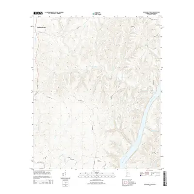
2014 Map of Windham Springs
USGS Topo · Published 2014About this map
Windham Springs serves as the primary focal point of this landscape, where the northern Tuscaloosa County terrain is defined by the deep carving of the Black Warrior River and the waters of Holt Lake. This 2014 survey reveals a transition from the upland ridges to the river valley, with the drainage network including Blue Creek, Davis Creek, and Yellow Creek shaping the topography. The road network, featuring names like Watermelon Rd and Lock 15 Rd, hints at the historical importance of river navigation and local access to the water's edge.
Find a feature on this map
41 named features on this map. Tap any name to fly to it.
Don’t see what you’re looking for? This feature index may not catch every label — zoom into the map to look around manually.
Map Details
Editions of this 2014 Windham Springs Map
This is the sole edition of this map. No revisions or reprints were ever made.
Other maps of this area

1893 · Jasper
USGS Topo · 1:125,000

1899 · Brookwood
USGS Topo · 1:125,000

1926 · Samantha
USGS Topo · 1:48,000

1928 · Samantha
USGS Topo · 1:62,500

1929 · Searles
USGS Topo · 1:48,000

1934 · Searles
USGS Topo · 1:62,500

1949 · Tutwiler School
USGS Topo · 1:24,000

1949 · Wiley
USGS Topo · 1:24,000
1951 · Tutwiler School
USGS Topo · 1:24,000

1951 · Wiley
USGS Topo · 1:24,000