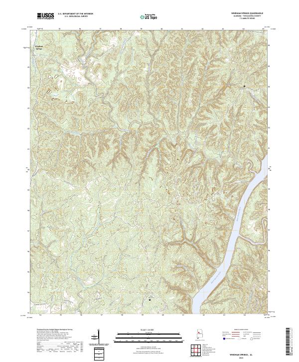
2024 Map of Windham Springs
USGS Topo · Published 2024About this map
Windham Springs serves as the primary landmark in this hilly region of Tuscaloosa County, where the topography is defined by the winding course of the Black Warrior River and its numerous tributaries. The landscape is deeply dissected by drainages such as Yellow Creek, Blue Creek, and Turkey Creek, which create a complex network of ridges and hollows. Local navigation and property boundaries are shaped by these waterways, with many secondary roads like Mcmillian RD and Watermelon RD following the high ground between creek beds.
Find a feature on this map
44 named features on this map. Tap any name to fly to it.
Don’t see what you’re looking for? This feature index may not catch every label — zoom into the map to look around manually.
Map Details
Editions of this 2024 Windham Springs Map
This is the sole edition of this map. No revisions or reprints were ever made.
Other maps of this area

1893 · Jasper
USGS Topo · 1:125,000

1899 · Brookwood
USGS Topo · 1:125,000

1926 · Samantha
USGS Topo · 1:48,000

1928 · Samantha
USGS Topo · 1:62,500

1929 · Searles
USGS Topo · 1:48,000

1934 · Searles
USGS Topo · 1:62,500

1949 · Tutwiler School
USGS Topo · 1:24,000

1949 · Wiley
USGS Topo · 1:24,000
1951 · Tutwiler School
USGS Topo · 1:24,000

1951 · Wiley
USGS Topo · 1:24,000