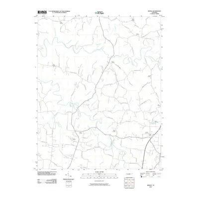
2010 Map of Windle
USGS Topo · Published 2010About this map
The Roaring River carves a winding path through this Overton County landscape, joined by numerous tributaries including Spring Creek and Mill Creek. This rural topography is defined by a deep network of family-named roads and cemeteries, reflecting generations of settlement in north-central Tennessee. Genealogists will find a significant concentration of burial sites, from Allen Chapel Cemetery in the north to Zion Hill Cemetery and Cobble Cemetery in the southeast. The map reveals the local infrastructure around Mason Lake, featuring the Mason Lake Dam and a web of community-focused routes like Hardys Chapel Rd and Windle Community Rd. These labels suggest a landscape organized around small congregations and family homesteads, such as the areas near Crawford Cemetery and Dodson Chapel Cemetery.
Find a feature on this map
90 named features on this map. Tap any name to fly to it.
Don’t see what you’re looking for? This feature index may not catch every label — zoom into the map to look around manually.
Map Details
Editions of this 2010 Windle Map
This is the sole edition of this map. No revisions or reprints were ever made.
Other maps of this area

1897 · Standingstone
USGS Topo · 1:125,000

1898 · Standingstone
USGS Topo · 1:125,000

1925 · Gainesboro
USGS Topo · 1:62,500

1929 · Gainesboro
USGS Topo · 1:62,500

1943 · Cookeville
USGS Topo · 1:100,000

1944 · Cookeville
USGS Topo · 1:100,000

1944 · Livingston
USGS Topo · 1:24,000

1951 · Windle
USGS Topo · 1:24,000

1953 · Cookeville East
USGS Topo · 1:24,000

1953 · Cookeville West
USGS Topo · 1:24,000