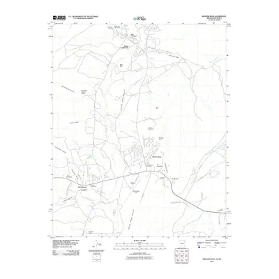
2010 Map of Window Rock
USGS Topo · Published 2010About this map
Fort Defiance and Window Rock serve as the primary hubs in this high-desert landscape, where the administrative centers of the Navajo Nation are intricately mapped. The terrain is defined by the broad Black Creek Valley, flanked by dramatic geological formations like The Haystacks and the Black Rock Natural Bridge. This 2010 survey highlights a unique economy of regional commerce, evidenced by numerous historical commerce sites including the Bonita Trading Post, Karrigan Trading Post, and Two Story Trading Post. Transport and infrastructure are represented by the WindowRock Airport and a network of tribal routes like Indian Rte-12. The presence of the Navajo Tribal Zoo and the Tse Bonito Campground indicates the area's role as a cultural and visitor destination, while the isolated Duclos Mine and features such as Disappearing Spring Wash speak to the specific resource and water management challenges of the high plateau.
Find a feature on this map
53 named features on this map. Tap any name to fly to it.
Don’t see what you’re looking for? This feature index may not catch every label — zoom into the map to look around manually.
Map Details
Editions of this 2010 Window Rock Map
This is the sole edition of this map. No revisions or reprints were ever made.
Other maps of this area

1886 · Wingate
USGS Topo · 1:250,000

1886 · Fort Defiance
USGS Topo · 1:250,000

1892 · Fort Defiance
USGS Topo · 1:250,000

1892 · Wingate
USGS Topo · 1:250,000

1954 · Gallup
USGS Topo · 1:250,000

1955 · Zith-Tusayan Butte 4 NW
USGS Topo · 1:24,000

1955 · Zith-Tusayan Butte 4 NE
USGS Topo · 1:24,000

1955 · Zith-Tusayan Butte 1 SE
USGS Topo · 1:24,000
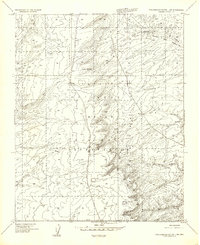
1955 · Zith-Tusayan Butte 1 SW
USGS Topo · 1:24,000

1955 · Tohatchi
USGS Topo · 1:62,500
Featured Places
- Fort Defiance, Fort Defiance Agency
- Fort Defiance Agency
- Window Rock, Fort Defiance Agency
- Eastern Navajo Agency, NM
- Bonita Trading Post, Fort Defiance Agency