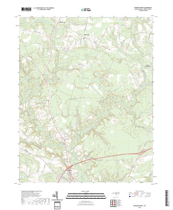
2022 Map of Windsor North
USGS Topo · Published 2022About this map
Windsor anchors the southern edge of this Bertie County landscape, situated where the Cashie River and its various tributaries begin to snake through the coastal plain. The terrain is defined by its complex drainage network, notably the Pell Mell Pocosin, a distinctive wetland feature that occupies a significant portion of the central map area. The settlement pattern follows a series of crossroads and rural corridors, with Askewville serving as a primary hub to the north, connected by routes such as Askewville Rd and Pocosin Rd.
Find a feature on this map
53 named features on this map. Tap any name to fly to it.
Don’t see what you’re looking for? This feature index may not catch every label — zoom into the map to look around manually.
Map Details
Editions of this 2022 Windsor North Map
This is the sole edition of this map. No revisions or reprints were ever made.
Other maps of this area

1901 · Williamston
USGS Topo · 1:62,500

1902 · Williamston
USGS Topo · 1:62,500

1943 · Plymouth
USGS Topo · 1:125,000

1953 · Norfolk
USGS Topo · 1:250,000

1953 · Rocky Mount
USGS Topo · 1:250,000

1954 · Rocky Mount
USGS Topo · 1:250,000

1972 · Republican
USGS Topo · 1:24,000

1972 · Aulander
USGS Topo · 1:24,000

1978 · Windsor South
USGS Topo · 1:24,000
1979 · Woodard
USGS Topo · 1:24,000