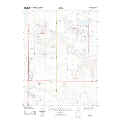
2013 Map of Windsor
USGS Topo · Published 2013About this map
Windsor and its surrounding agricultural plains are defined by an intricate network of water management, vital to the development of this northern Colorado corridor. The Cache la Poudre River winds through the northern portion of the landscape, while the Big Thompson River flows to the south. Between these rivers, a complex system of irrigation canals and ditches, including the Eaton Ditch, Louden Ditch, and the Loveland and Greeley Canal, supports the local farmland. Small, localized settlements such as Kelim, Officer, Gove, and Koenig appear along the roads and rail lines, marking historical nodes of transit and commerce. The presence of Lakeview Cem and the Jeffers School provides essential markers for genealogical research and local history within this boundary area of Larimer and Weld counties.
Find a feature on this map
46 named features on this map. Tap any name to fly to it.
Don’t see what you’re looking for? This feature index may not catch every label — zoom into the map to look around manually.
Map Details
Editions of this 2013 Windsor Map
This is the sole edition of this map. No revisions or reprints were ever made.
Other maps of this area

1902 · Greeley
USGS Topo · 1:125,000

1906 · Loveland
USGS Topo · 1:62,500

1906 · Fort Collins
USGS Topo · 1:62,500

1907 · Livermore
USGS Topo · 1:125,000

1908 · Loveland
USGS Topo · 1:62,500

1908 · Fort Collins
USGS Topo · 1:62,500

1908 · Eaton
USGS Topo · 1:125,000

1909 · Livermore
USGS Topo · 1:125,000

1910 · Eaton
USGS Topo · 1:125,000

1950 · Windsor
USGS Topo · 1:24,000