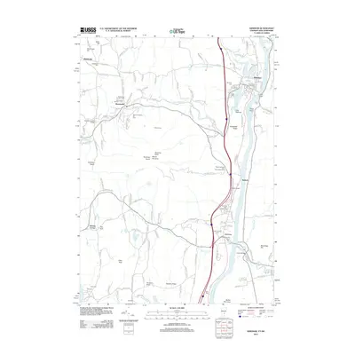
2012 Map of Windsor
USGS Topo · Published 2012About this map
Windsor stands at the eastern edge of this landscape, where the Connecticut River separates the settlements of Vermont from the hills of New Hampshire. The area is defined by the massive presence of Mount Ascutney, which dominates the central terrain with its ski area and numerous peaks like Ascutney North and Ascutney South. This 2012 survey illustrates a region where industrial history and modern recreation meet, featuring landmarks like the Cornish Bridge and the Bowers Covered Bridge alongside Miller Airport.
Find a feature on this map
148 named features on this map. Tap any name to fly to it.
Don’t see what you’re looking for? This feature index may not catch every label — zoom into the map to look around manually.
Map Details
Editions of this 2012 Windsor Map
This is the sole edition of this map. No revisions or reprints were ever made.
Other maps of this area

1906 · Hanover
USGS Topo · 1:62,500

1908 · Hanover
USGS Topo · 1:62,500

1911 · Woodstock
USGS Topo · 1:62,500

1913 · Woodstock
USGS Topo · 1:62,500

1926 · Claremont
USGS Topo · 1:62,500

1928 · Ludlow
USGS Topo · 1:48,000

1929 · Claremont
USGS Topo · 1:62,500

1929 · Ludlow
USGS Topo · 1:62,500

1932 · Ludlow
USGS Topo · 1:62,500

1943 · Woodstock
USGS Topo · 1:62,500