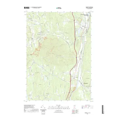
2021 Map of Windsor
USGS Topo · Published 2021About this map
Mt Ascutney dominates the central landscape of this Vermont and New Hampshire border region, where the Connecticut River serves as a winding dividing line between the two states. The topography transitions from the dramatic height of the mountain and Ascutney Notch down to the river valley, where historic river crossings like the Cornish-Windsor Bridge and Lottery Bridge link the communities. Small settlements such as Sheddsville, Brownsville, and Ascutney are scattered throughout the hills, many defined by their proximity to Mill Brook. This area is notably rich in early American heritage, featuring the Saint-Gaudens National Historic Site and a dense network of local burial grounds, including the Old South Church Cem and the Tuttle Cem. The map illustrates a landscape where early industry, represented by Mill Pond, evolved alongside conservation and cultural preservation efforts.
Find a feature on this map
126 named features on this map. Tap any name to fly to it.
Don’t see what you’re looking for? This feature index may not catch every label — zoom into the map to look around manually.
Map Details
Editions of this 2021 Windsor Map
This is the sole edition of this map. No revisions or reprints were ever made.
Other maps of this area

1906 · Hanover
USGS Topo · 1:62,500

1908 · Hanover
USGS Topo · 1:62,500

1911 · Woodstock
USGS Topo · 1:62,500

1913 · Woodstock
USGS Topo · 1:62,500

1926 · Claremont
USGS Topo · 1:62,500

1928 · Ludlow
USGS Topo · 1:48,000

1929 · Claremont
USGS Topo · 1:62,500

1929 · Ludlow
USGS Topo · 1:62,500

1932 · Ludlow
USGS Topo · 1:62,500

1943 · Woodstock
USGS Topo · 1:62,500